

Atashhir neighborhood
The history of Atashhir region
Ataşehir region is even older than Istanbul. While the first human settlements around Istanbul were established between 5000 and 3000 BC, the first stone age hand axes were found in Ataşehir. Orhan Gezi in May 1331; Byzantine King III in Kartal-Choislik. defeated Andronicus. He went to Oscodar.
Knoralp, one of his commanders; Aidus Castle took the village of Ayazma in the western foothills of Kayışdağı, and now Ataşehir, and merged with Orhan Bey in Üsküdar. Law No. 5747 on the establishment of areas within the metropolitan municipality and amending some laws on March 6, 2008 by the Grand National Assembly of Turkey to It was approved.
In the 18th paragraph of Article 1 of the law under the title "Establishment of the District", the Atashehir region is defined as follows: "The Atashehir region was established in order to establish a municipality of the same name with neighborhoods in Istanbul province." At that time, very large vineyards, churches, There was a bathroom and a water tank. The Byzantines and the priests were very upset that this place fell into the hands of the Turks. Especially women believed that bath water makes them beautiful.

Growing vegetables and fruits was the livelihood of many priests. In this region, when the Ottoman Turks passed through, they brought many Anatolian people with them and settled especially in Merdivenköy. Warrior clerics such as Guzko Baba, Eren Baba, Kartela Baba, Ali Gazi, Sari Gazi among the students of Giikli Baba and hundreds of their followers settled in Christian villages.
These warriors allied themselves with the Greeks to protect themselves from pirate attacks. Teke Bagh village was established in this way in 1335. The only problem of the village was the lack of water. This area was under the rule of Eren Baba and Ali Ghazi. After 1465, the name of Ernakoy region was transferred to the land registry office, and after 1639, when Kishdaghi water was brought to Ernakoy by pipe, the people of Karaman farm and Teke Bagh migrated to Ernakoy.
In 164, Mustafa Agha, a shipyard manager, built a mosque, which in 1860 became one of the seven neighborhoods of Kadikoy. When the railway and station in the west of the district were built in 1872, the current location was named Erancoy at the suggestion of the line commander, Captain Ali Bey. Mehmet Chavosh Mosque was first built in 1665 and then rebuilt in 1924. Since the main Erancoy was in the interior of the country and some Erans settled further inside it, this area took this name and became Atashhir.
Geographic features of Atashir region
Ata Shahir is a region with an area of 25.84 square kilometers and includes 17 neighborhoods. According to the census, this region has a population of about 361,615 people. The coordinates of this area are 40°59'0, 29°7'0, an area in Istanbul on the Anatolian side. In 2008, Kadıköy became a district with the participation of the separated districts of Üsküdar, Ümraniye, Maltepe and Kartal.
In 2008, it gained the status of a city. This city is bordered by Maltepe from the south, Kadıköy from the west, Üsküdar from the northwest, Imraniye from the north, Çakme Koy from the northeast, and Sancaktepe from the east.
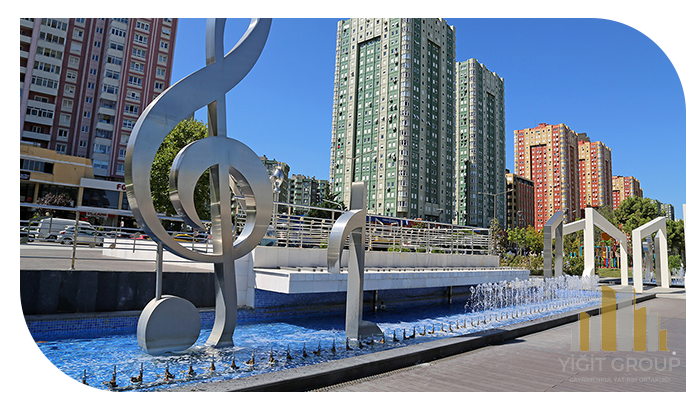
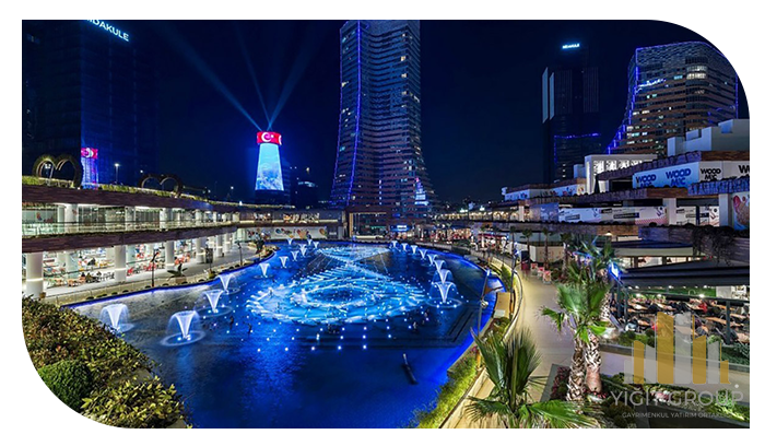
Sightseeing places and historical monuments of Atashhir region
• Botanical Park
Mimar Senan Grand Mosque
• Water Garden entertainment complex
